Cultural Cartography
Maps can enable just futures when they are used as community tools in thoughtful methodologies.
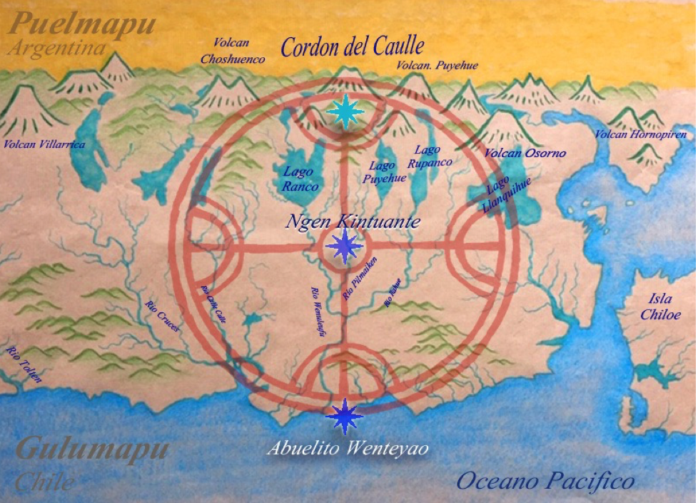
Working with maps and communities, Sarah guides participatory mapmaking to visualize waters, disasters, and cultural values. In collaboration, she conducts “deep mapping” which is a concept from the environmental humanities to navigate knowing across multiple worlds. Deep mapping includes multiple ways of moving through territory and visualizing territory. Her work is based in digital and physical paper maps, but it also involves intercultural water transects and other interdisciplinary collaobrations. The maps pictured above are from collaborations in Mapuche-Williche territory.
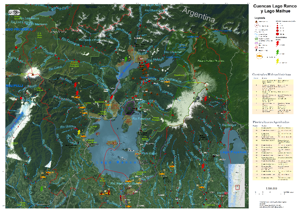
GIS Maps (images with textual overlay): Jose Miguel Valdés Negroni made the majority of the GIS maps working with the Alianza Territorial Puelwillimapu. The majority were published in Kelly, 2018
Artistic Maps: Sergio Iacobelli made these in conversation with Sarah’s research and guided by the protocol of the Alianza Territorial Puelwillimapu. Published in Kelly, 2018
Kultrun Maps: Sergio Iacobelli, Julio Muñoz and Sarah made these maps in collaboration guided by the Machi Millaray Huichailaf. Kelly, 2019


Cartographies of
Slow Disasters
My most recent article in-review is on the cartographies of slow disasters that chart more-than-human disaster risks. I am currently preparing a report for the environmental court in Chile as an expert witness. My methodological task involves documenting the synergic impacts of very harmful land development projects that altered the hydro-geology, flaura, fauna, and Mapuche-Williche Indigenous communities living in the coastal mountain landscape of the Valdivian coast. Working with lawyer Felipe Guerra, we are developing a legal geography method to support environmental justice in Chile.
Intercultural Water Transects
Intercultural water transects are a form of cultural geography. To conduct research that informs Mapuche-Williche participation in environmental protection and court case proceedings, I use transects to gather cultural cartography data. This work inspired a current project I guide called “EpuLakfenMapu: Transecto Intercultural Cuenca Maihue-Ranco” / “Two Lake Territories: Intercultural Transect of the Maihue-Ranco watershed”. I coordinate the technical team of this yearly research trip with two Mapuche-Williche women, Antumalen and Claudia Antillanca, who coordinate ancestral Mapuche-Williche leaders and communities throughout their territory, Puelwillimapu.

Intercultural Water Transect in Lago Maihue, Puelwillimapu. March 2022

Territorial Control: Mapping COVID-19
Mapuexpress features a live map of Mapuche territory that tracks the spread of COVID-19 and it’s impact on the community as well as providing resources based on location. This online map is made in a collaboration with Mapuexpress and colleagues Dr. Valentina Carraro, José Miguel, and Sarah.